Analysis Potential Land Subsidence in Natural Tourism Area of Aik Bukaq
DOI:
https://doi.org/10.56099/jrgi.v6i02.78Keywords:
Penurunan Muka Tanah, DinSAR, Sentinel 1AAbstract
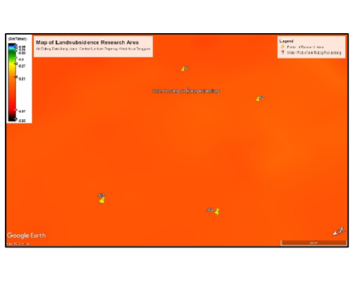
Land movement is one of natural disaster that occurs unexpectedly. So, the mitigation needs to be provided as early as possible to avoid the impact of the disaster. One of the land movements that often occurs is land subsidence. Within this paper aims to analyze the value of land subsidence in the Nature Tourism area of Aik Bukaq. The land movement was estimated from Sentinel 1A image data with starting from the data range for April 2022 – 2024 and processed using the DInSAR (Differential Interferometry Synthetic Aperture Radar) method in SNAP software. The DinSAR method is one of method that often used to analyze the value of land subsidence. Because it’s able to record data in any condition. After processing data in SNAP software, land subsidence values were read and mapped at the coordinate points of research area using Google Earth Pro software. Therefor results obtained the average value of land subsidence in last of 2 years (2022 – 2024), from -0,18 cm/year and -0,21 cm/year respectively. With an average of -0,114 cm/year which is included in the very low land subsidence category. However, there is a significant increase of value in the last 2 years, which really needs to be beware as an initial step to mitigate the impacts of land movement disasters. Because at any time it can happen in the Nature Tourism area of Aik Bukaq
References
Andreas, B. Dan Luis, V., 2015. TOPS Interferometry Tutorial, in: Toolbok Sentinel-1. Skywatch. pp. 10–11.
Bayuaji, L., Sumantyo, J.T.S., Kuze, H., 2010. ALOS PALSAR D-InSAR for land subsidence mapping in Jakarta, Indonesia. Can. J. Remote Sens. 36, 1–8. https://doi.org/10.5589/m10-023
BPBD, 2019. Panduan Pembelajaran Kebencanaan di Kabupaten Lombok Tengah. Lombok Tengah.
Castañeda, C., Pourthié, N., Souyris, J.C., 2011. Dedicated SAR interferometric analysis to detect subtle deformation in evaporite areas around Zaragoza, NE Spain. Int. J. Remote Sens. 32, 1861–1884. https://doi.org/10.1080/01431161003631584
Dang, V.K., Doubre, C., Weber, C., Gourmelen, N., Masson, F., 2014. Recent land subsidence caused by the rapid urban development in the Hanoi region (Vietnam) using ALOS InSAR data. Nat. Hazards Earth Syst. Sci. 14, 657–674. https://doi.org/10.5194/nhess-14-657-2014
Fárová, K., Jelének, J., Kopačková-Strnadová, V., Kycl, P., 2019. Comparing DInSAR and PSI techniques employed to Sentinel-1 data to monitor highway stability: A case study of a massive Dobkovičky landslide, Czech Republic. Remote Sens. 11. https://doi.org/10.3390/rs11222670
Francis, P.W., Wadge, G., Mouginis-Mark, P.J., 1996. Satellite monitoring of volcanoes, dalam R. Scarpa and R.I. Tilling (eds.) Monitoring and mitigation of volcano hazards. Springer, Berlin, Heidelb. 257–298.
Haqqi, M.K.F., 2015. Survei Pendahuluan Deformasi Muka Tanah Dengan Pengamatan Gps Di Kabupaten Demak. J. Geod. Undip Oktober 2015, 4(April), 267–276. 4, 316–324.
Islam, L.J.F., Prasetyo, Y., Sudarsono, B., 2017. Analisis Penurunan Muka Tanah (Land Subsidence) Kota Semarang Menggunakan Citra Sentinel-1 Berdasarkan Metode Dinsar Pada Perangkat Lunak Snap. J. Gedesi Undip 5, 200–207.
Kurniawan, A., Yuwono, B., Sabri, L., 2013. Analisis Penurunan Muka Tanah Daerah Semarang Menggunakan Perangkat Lunak Gamit 10.04 Kurun Waktu 2008-2013. J. Geod. Undip 2, 84062.
Nam, B.X., Van Anh, T., Bui, L.K., Long, N.Q., Le Thu Ha, T., Goyal, R., 2021. Mining-Induced Land Subsidence Detection by Persistent Scatterer InSAR and Sentinel-1: Application to Phugiao Quarries, Vietnam. Lect. Notes Civ. Eng. 108, 18–38. https://doi.org/10.1007/978-3-030-60269-7_2
Nitti, D.O., Bovenga, F., Refice, A., Wasowski, J., Conte, D., Nutricato, R., 2009. L- and C-Band SAR interferometry analysis of the wieliczka salt mine area (unesco heritage site, poland). Eur. Sp. Agency, (Special Publ. ESA SP 664 SP.
Pepe, A., Calò, F., 2017. A review of interferometric synthetic aperture RADAR (InSAR) multi-track approaches for the retrieval of Earth’s Surface displacements. Appl. Sci. 7. https://doi.org/10.3390/app7121264
Vinet, L., Zhedanov, A., 2011. A “missing” family of classical orthogonal polynomials, Journal of Physics A: Mathematical and Theoretical. https://sentinel.esa.int/document/247904/685163/Sentinel1_User_Handbook. https://doi.org/10.1088/1751-8113/44/8/085201
Whittaker, B.N. dan R., 1989. Subsidence Occurrence, Prediction, and Control. Elsevier Sci. Publ. Co. INC.
Yudha, E., Mulyo, B., Yuwono, Wiweka, 2011. Studi Deformasi Gunung Merapi Menggunakan Teknologi Interferometry Synthetic Aperture Radar (InSAR), in: Jurnal ITS. Teknik Geomatika, Institut Teknologi Sepuluh November, Surabaya, pp. 1–7.
Downloads
Published
How to Cite
Issue
Section
License
Copyright (c) 2024 Jurnal Rekayasa Geofisika Indonesia

This work is licensed under a Creative Commons Attribution 4.0 International License.