Investigation of Landslide in The Slippery Area in The Anduna Village Road Section, South Konawe Regency, Using The Wenner-Schulemberger Resistivity Configuration Method
DOI:
https://doi.org/10.56099/jrgi.v7i01.51Keywords:
Bidang Gelincir, Geolistrik, Konfigurasi Wenner-SchulembergerAbstract
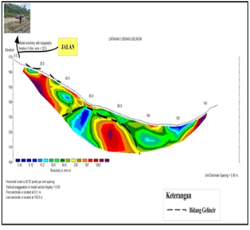
This research has been conducted in Anduna Village Road Section, Laeya Sub-district, South Konawe Regency, Southeast Sulawesi Province which aims to determine the subsurface structure based on resistivity values and provide a 2D cross-section of the subsurface that has the potential as a sliding field in the research area. The method used is resistivity geoelectric method. Geoelectric measurements were carried out as many as 3 passes using the Wenner-Schulemberger configuration. With the length of tracks 1, 2, and 3 each 150 meters. Geoelectric data processing is carried out using Res2Dinv software so as to obtain a 2D cross section to determine the potential for sliding fields. Based on the analysis of the rock resistivity value of the study area, the surface that has the potential for sliding fields on track 1 is at a depth of 1.25 - 28.7 meters with a resistivity value of 6.76 - 713 Ωm. On track 2 is at a depth of 19.8 meters with a resistivity value of 736 - 845 Ωm for the cross section of track 3 resistivity value of 38.0 - 236 Ωm the boundary of this sliding field is at a depth of 19.8 meters.
References
Darsono. 2012. identifikasi bidang gelincir pemicu bencana tanah longsor dengan metode resistivitas 2 dimensi di desa pablengan kecamatan matesih kabupaten karanganyar Indonesia. Journal of Applied Physics, vol 2, 57-66.
ESDM. 2007. Pengenalan Gerakan Tanah. https://www.esdm.go.id/Publikasi/lain lain/doc%20download/489.pengenalan-gerakan-tanahhtml. Diakses pada tanggal 18 Februari 2018 pukul 10.25 WIB.
Herlin. 2012. Penentuan Bidang Gelincir Gerakan Tanah Dengan Aplikasi Geolistrik Metode Tahanan Jenis Dua Dimensi Konfigurasi Wenner- Schlumberger (Studi Kasus di Sekitar Gedung Fakultas Kedokteran Universitas Andalas. Jurnal Fisika Unand 1, 19–24.
Loke, M.H.,1999, Electrical Imaging Surveys for Environmental and Engineering Studies, Malaysia.
Rusmana, E., Sukido, Sukarna, D., Haryono, Simandjuntak, T.O.,1993, Geologi
Lembar Lasusua-Kendari, Sulawesi, Pusat Penelitian dan Pengembangan Geologi, Bandung
Sakka, 2001, Metoda Geolistrik Tahanan Jenis, Fakultas Matematika dan Ilmu Pengetahuan Alam Universitas Hasanuddin, Makassar.
Simandjuntak, T.O., Surono, dan Sukido, 1993c. Peta Geologi Lembar Kolaka, Sulawesi, skala 1: 250.000. Pusat Penelitian dan Pengembangan Geologi.
Subekti, Imam. 2016. Geologi Umum. Cet. I; Yogyakarta : Tekuosain.
Sunaryo, Rahmansyah Dan Sisinggih. 2003. Penentuan Aquifer Dengan Metode Geolistrik Resistivitas Di Desa Tempuran, Jatilangkung Dan Awang-Awang, Kec Pungging, Kab Mojokerto. Proceedings Of Joint Convention Jakarta
Telford W.M.., Geldart, L.P., Sherif, R.E. 1990. “Applied Geophysics”, 2 nd editionn : Cambridge University Press. New York
Utiya, J., As’ari, A., & Tongkukut, S. H. 2015. Metode Geolistrik Restivitas Konfigurasi Wenner-Schlumberger Dan Konfigurasi Dipole-Dipole Untuk Identifikasi Patahan Manado Di Kecamatan Paaldua Kota Manado. Jurnal Ilmiah Sains, 17(1), 135. https://doi.org/10.35799/jis.15.2.2015.10228.
Pujiastuti, D., Indrawati, Edwiza. D., dan Mustafa, B., 2009, Penentuan Kedalaman Bidang Gelincir Daerah Rawan Gerakan Tanah dengan Metode Tahanan Jenis (Studi Kasus Dua titik Pengamatan di Kampus Unand Limau Manis Padang), Prosiding seminar Nasional Fisika Univesitas Andalas (SNFUA), (Hal 42-54)
Zakaria, Z. 2015. Analisis Kestabilan Lereng Tanah. Universitas Padjajaran. Bandung.
Downloads
Published
How to Cite
Issue
Section
License
Copyright (c) 2025 Jurnal Rekayasa Geofisika Indonesia

This work is licensed under a Creative Commons Attribution 4.0 International License.